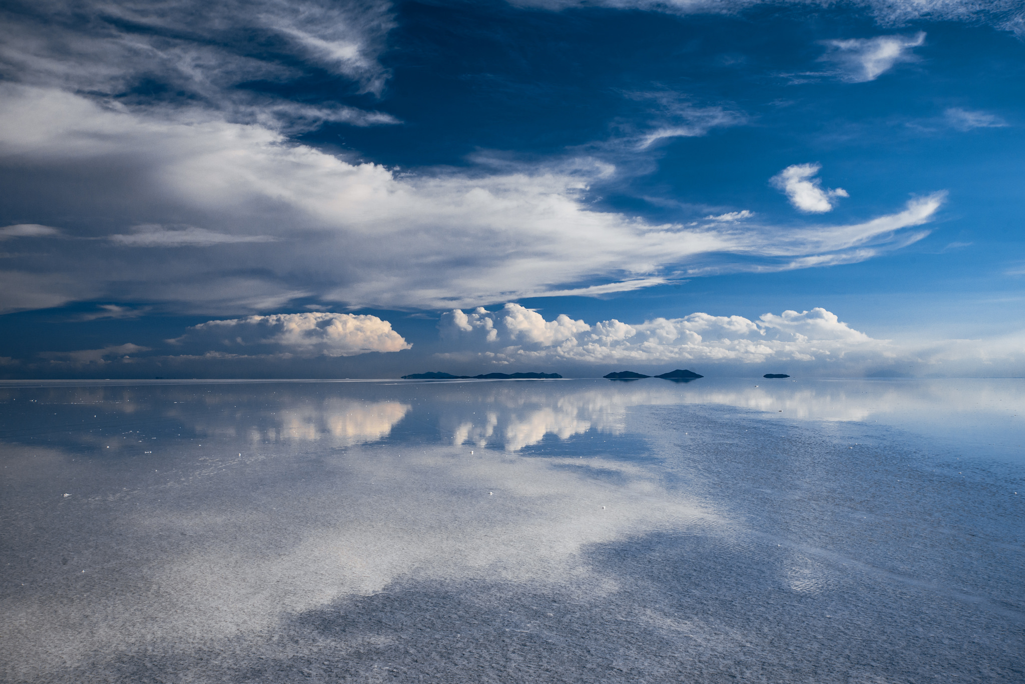
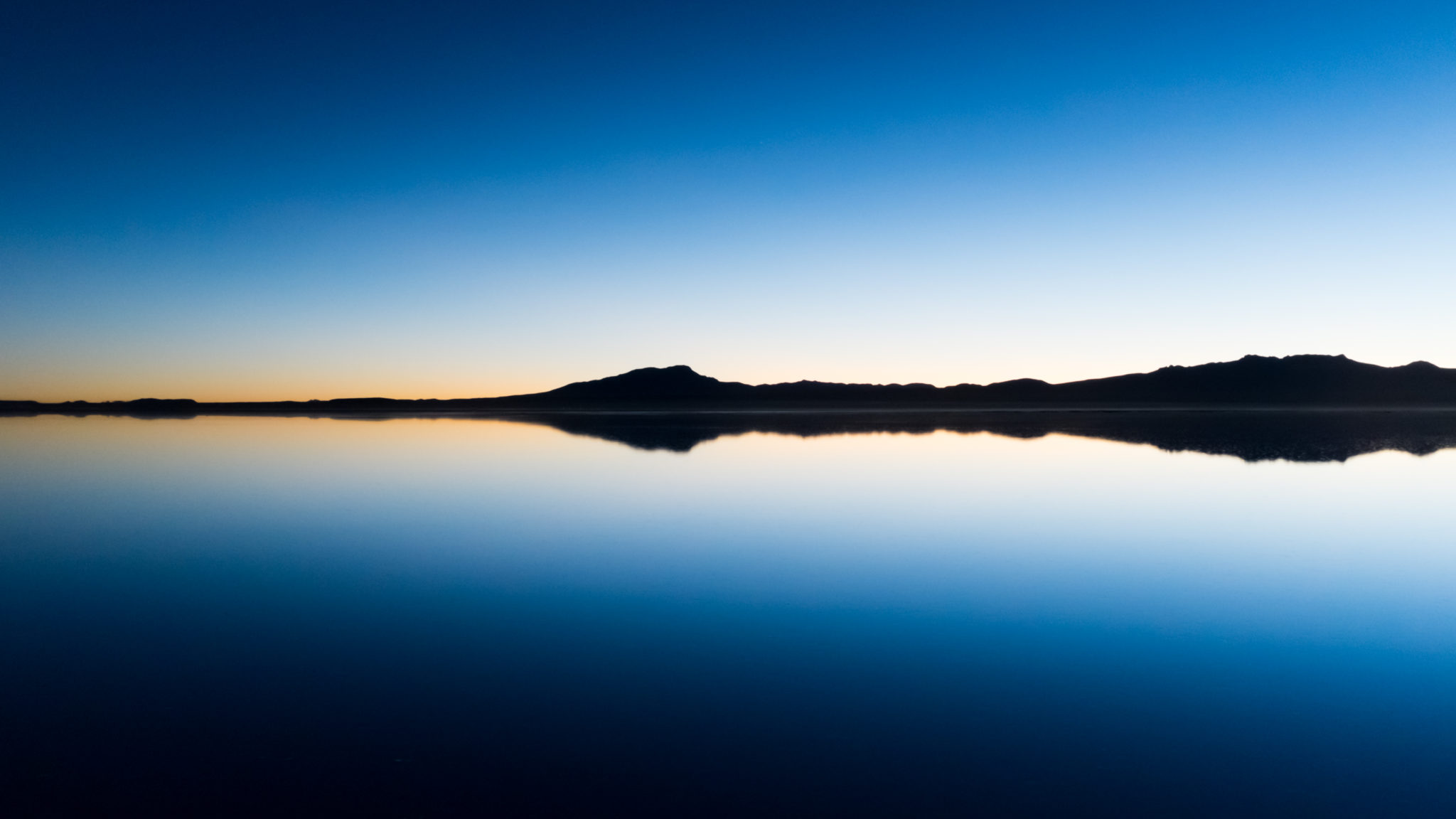
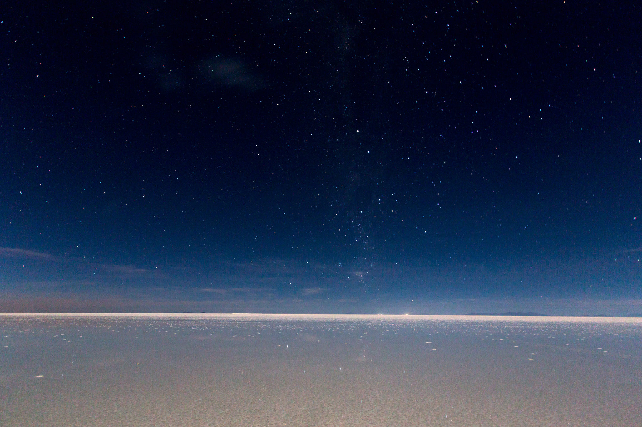
Driving the Uyuni Salt Flats, Altiplano, Bolivia, is an adventure in the middle of Bolivia. The Uyuni Salt Flats, surrounded by the Bolivian Altiplano, is a saline desert so wide that it can be seen from space. The infinite white under your feet is only interrupted when it joins the blue sky, an endless horizon. Standing on this impressive canvas of reflections is surely unforgettable. A thin layer of water reflecting everything around it, just like a mirror would do.
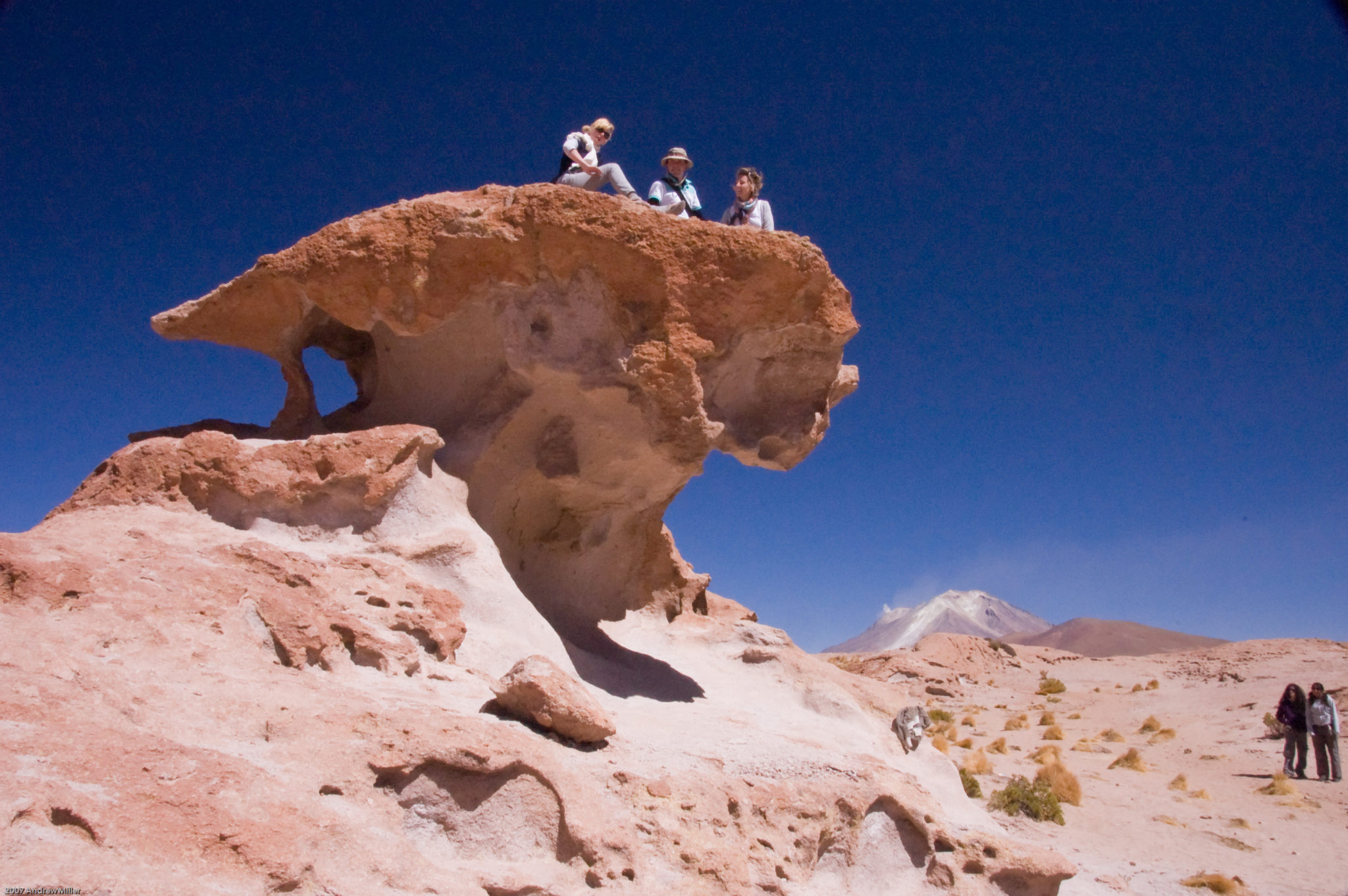
Located in the southwest of Bolivia, the Uyuni Salt Flats is the largest in the world. This semi-desert and volcanic land region contain landscapes of extraordinary natural beauty. There are also rock formations, volcanic wells, and spectacular geysers, taking you back to the time when the earth was born.
Things to Do
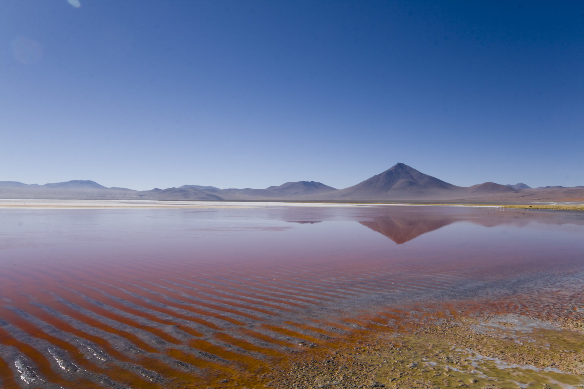
Colorful Lagoon
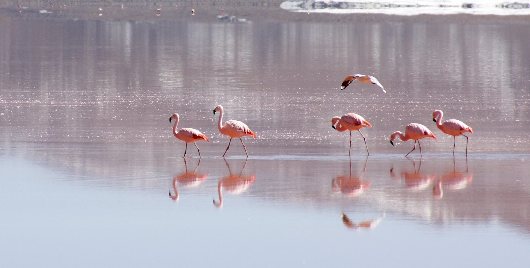
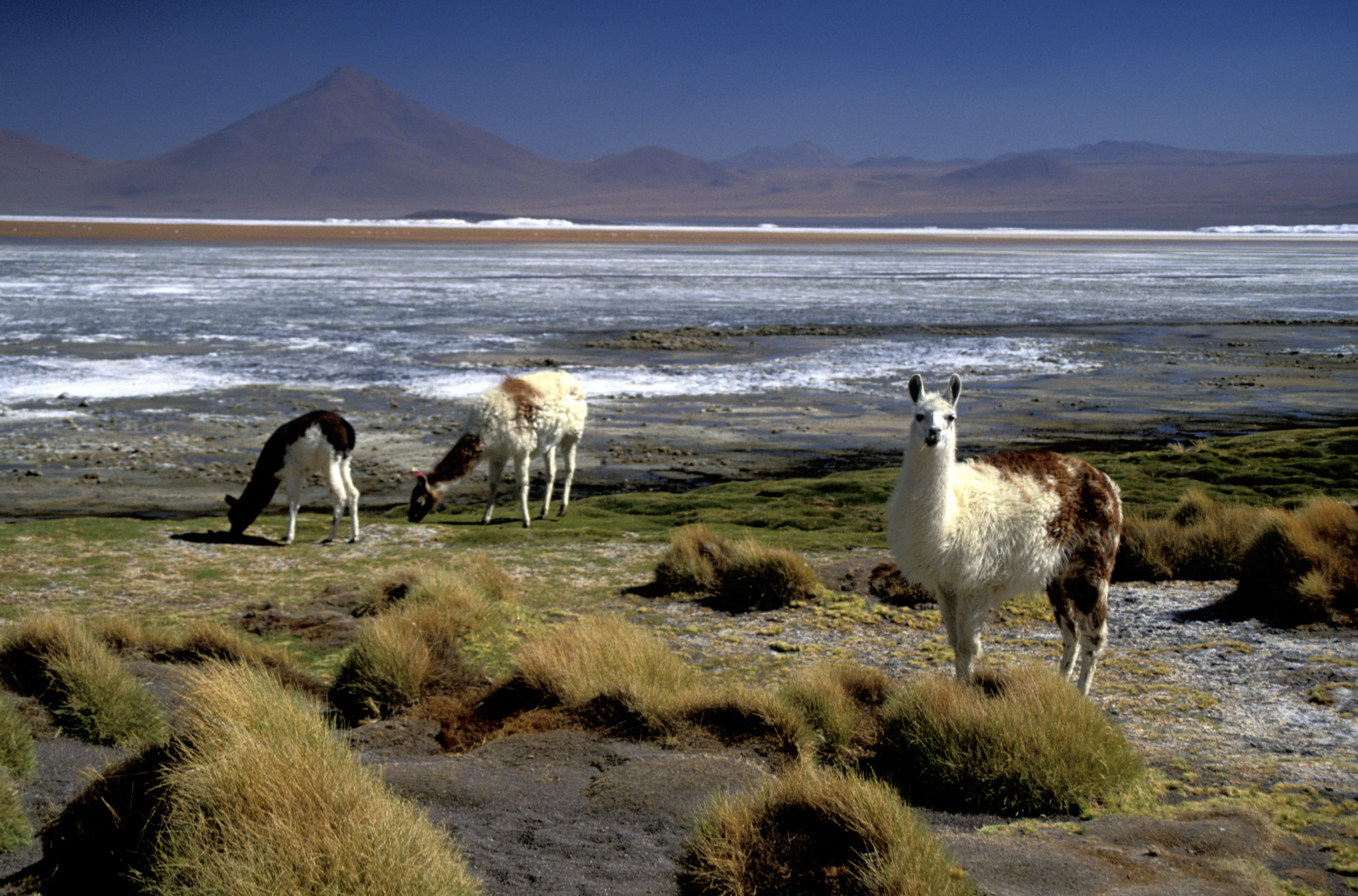
Its name comes from the different colors the waters reflect. Shades of green, yellow, and light blue mix and form a breathtaking display. It is the best site in the region to spot flamingos, its three species gracefully dotting the lagoon. This makes it the largest population of the Parina, and the most representative mammals of the region. Besides, you can find the vicuña, the vizcacha, and the llama.
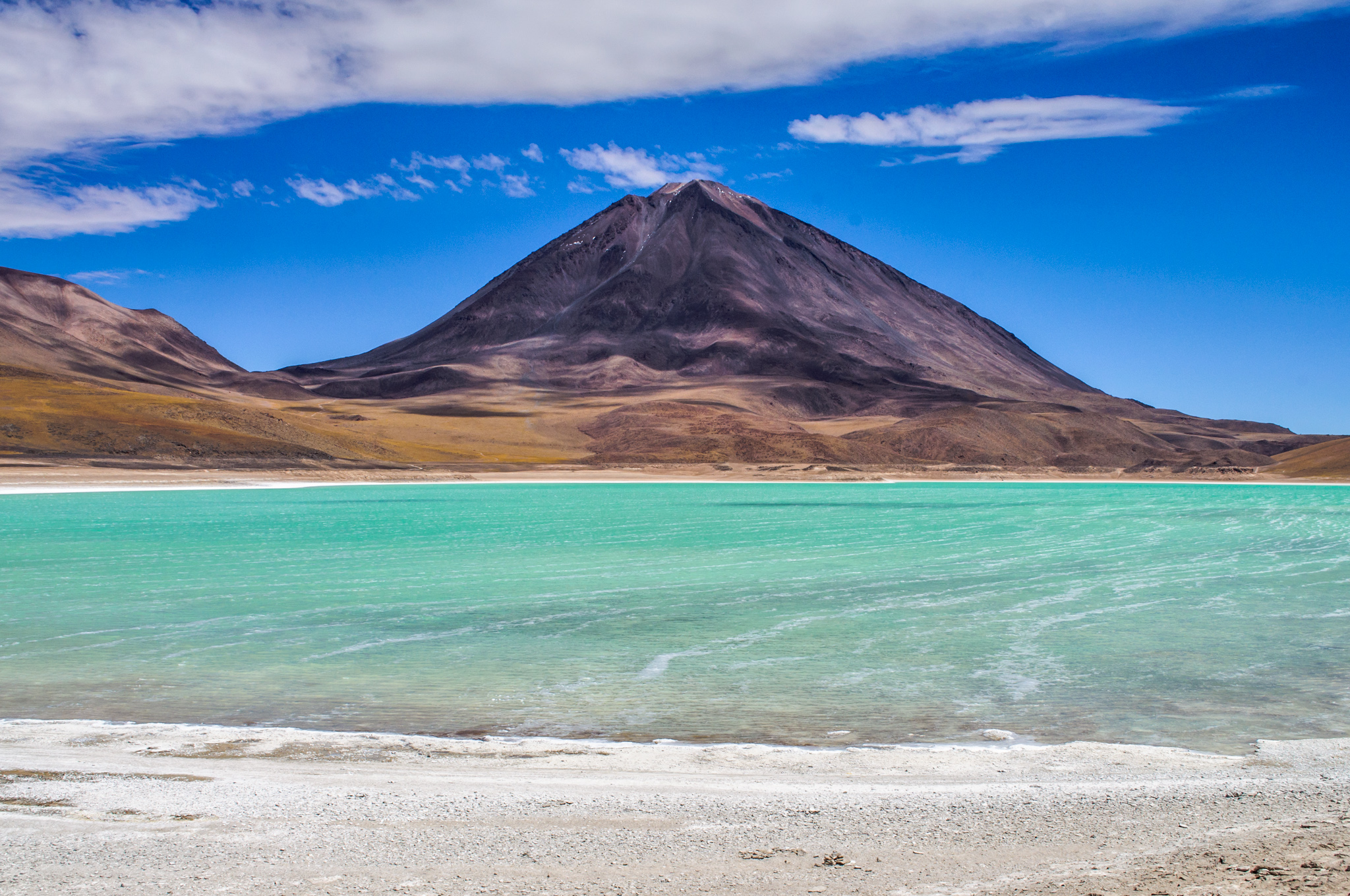
Green Lagoon
Located at the southern end of the Reserve, Green Lagoon has an area of 17 km2, divided into two bodies of water. Its color is emerald green due to the high magnesium on its waters. Next to this lagoon is the Llicancabur volcano, standing 5,868 meters above sea level, where you can practice mountaineering and hiking.
Sun of Tomorrow
With an area of 1 km2, this is located south of Colorful Lagoon, on the way to the salt of Chalviri. It is characterized by intense volcanic and fumarolic activity. In the craters, you can see lava boiling intensely. Additionally, the fumaroles emit mixed vapors of water and hot steam reaching heights of 80 to 100 meters.
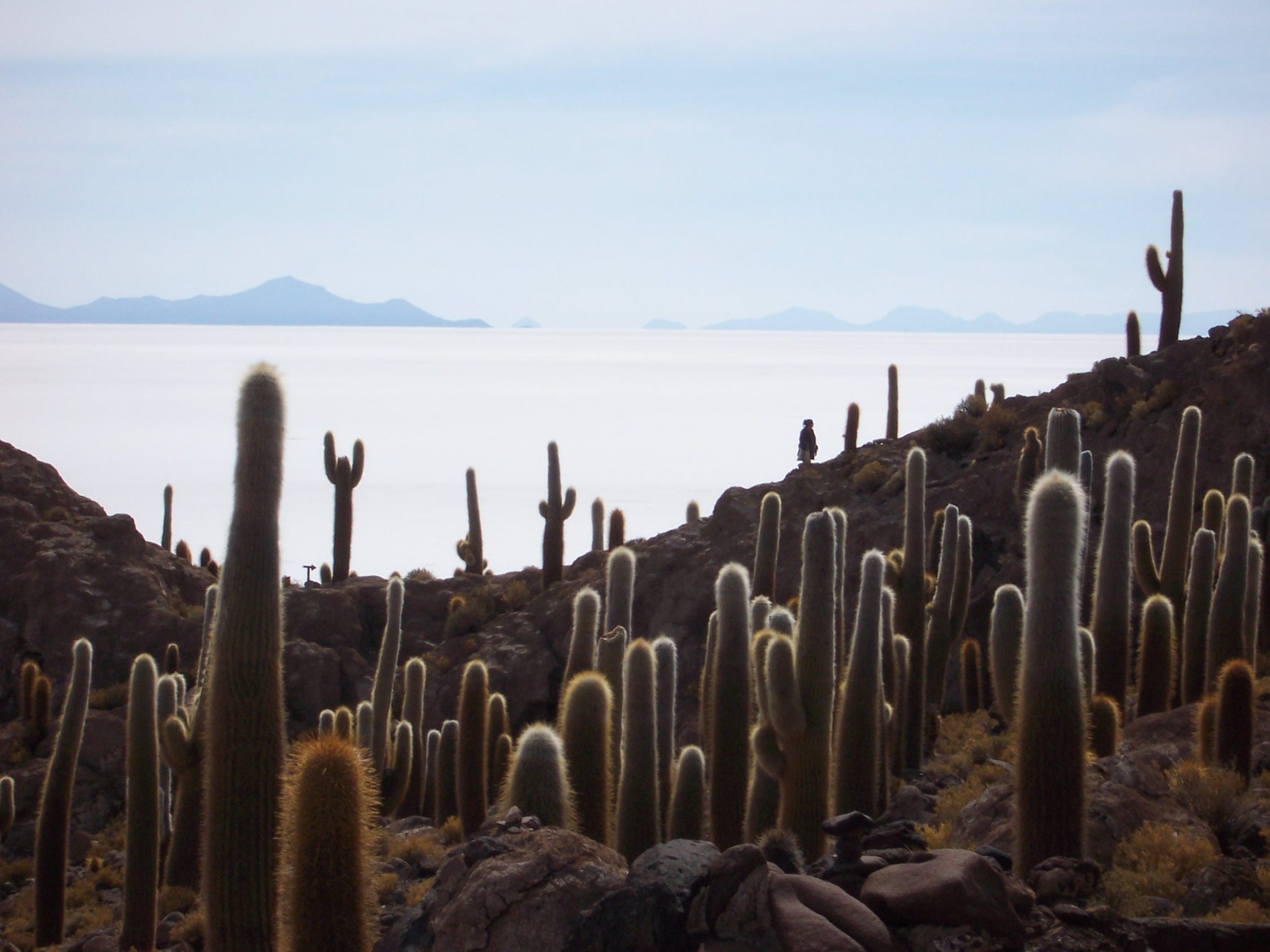
Fish Island
In the heart of the Salar is Fish Island, which is reached in 10 hrs. It is the largest of a set, standing like an isolated ecosystem, an oasis in the Salar. The island is populated by a large number of cacti with heights greater than 8 meters, the largest being 12 meters high. This landscape added to the saline horizon makes the place one of the best places for photography lovers.
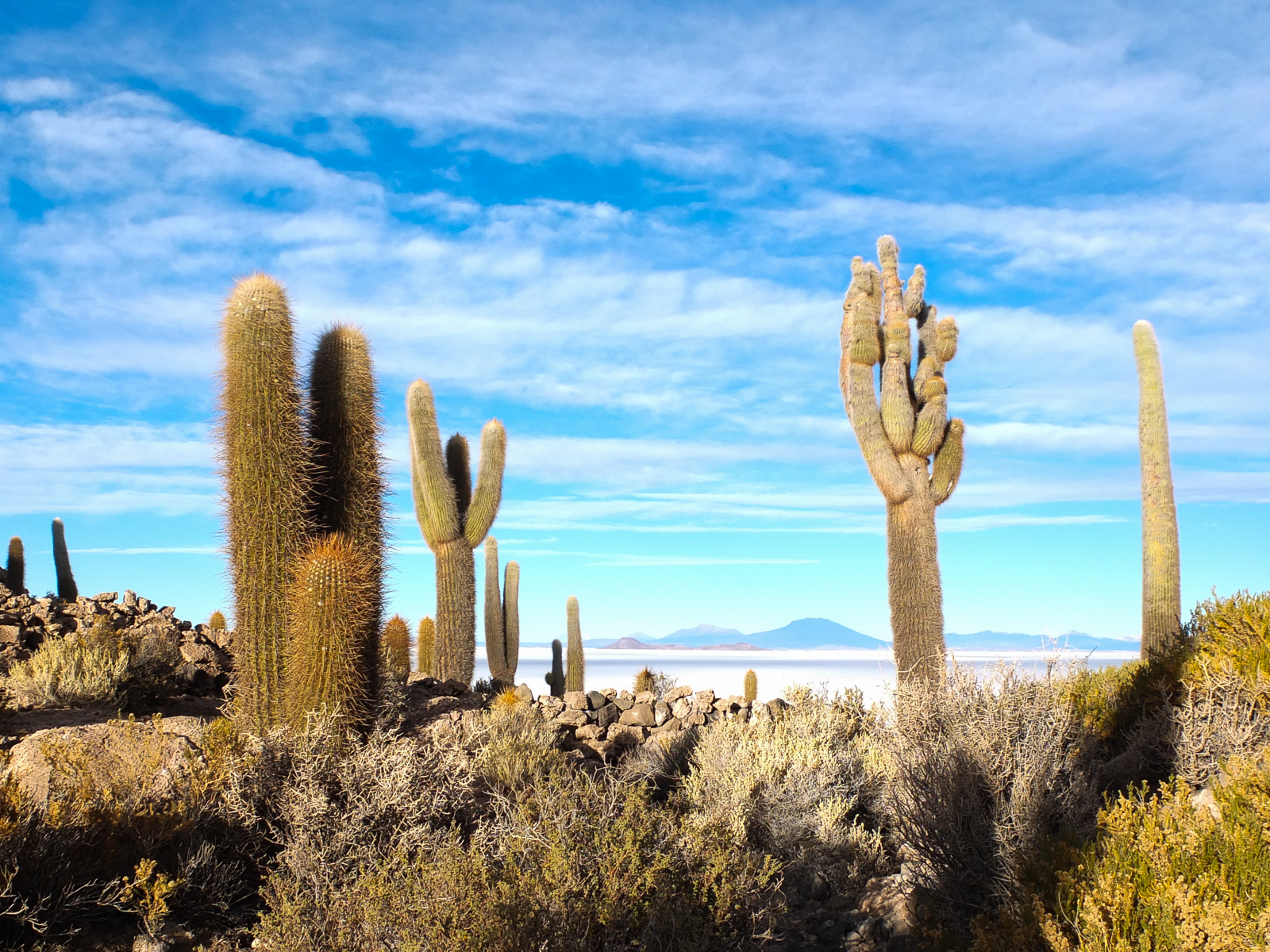
When one sees the island in the distance, it gives the impression that a giant fish emerges from deep within the Salar. Its traditional name is Inka Wasi, and the land is made up of fossils of marine algae.
With all these natural wonders, its 12,000 square kilometers of extension and an altitude of 3,650 meters above sea level, the Uyuni Salt Flats is currently the largest lithium reserve in the world; a wonder of nature that is worth knowing.
How to get there
You can take a bus to go from La Paz to Uyuni, the town nearest the Salt Flats. These bus rides are around 13 hours long. From Oruro to Uyuni, there is a train offering a comfortable journey to the Salt Flats.
When to go
During the dry season (from April to October), all the attractions can be visited, and all formations can be truly admired.
On the rainy season (from November to March), some 20cm of water cover the Uyuni Salt Flat. That’s when it becomes an infinite mirror, reflecting the sky and the clouds. At this time of the year, the flamingos are everywhere.
Keep in mind that the highway from La Paz to Oruro is paved just until the Challapata town. The road is a dirt road from that point, and during the rainy season, getting through is pretty hard.
If you loved this article or found it useful, don’t forget to share it with your adventurous and travel-hacking friends! If you want more posts like this, follow us on Youtube, Instagram, Pinterest, Twitter or Facebook and subscribe to our newsletter!